Important rivers of Northeast India

WhatsApp Channel
Join Now
Northeast India is a picturesque place comprising many natural beauties, among which are the vital rivers of Northeast India, including the Brahmaputra, Dibang, and Teesta. These waterways are fundamental to the region’s sustenance, serving as avenues for transport, irrigation, and biodiversity. The Brahmaputra, with its origin in the Himalayas, nurtures lands as it courses through. The Dibang enriches the Arunachal and Assam landscapes, while the Teesta navigates through Sikkim and West Bengal. These rivers unite communities, provide resources for crops, and create habitats for diverse creatures. Their significance extends beyond water flow, shaping the livelihoods and ecology of Northeast India’s inhabitants.
Dibang River, Arunachal Pradesh
The Dibang River is an important part of the Brahmaputra River system. It flows through two northeastern Indian states, Arunachal Pradesh and Assam. There’s a district in Arunachal Pradesh called the Dibang Valley, named after this river. The Dibang River’s journey starts in the Great Himalayan Mountain Range. The upper part of the Dibang River flows near a place known as the Mishmi Hills. The river moves through the middle of the lower Dibang valley and meets with the Lohit River which then flows along the northern side of the Saikhowa Reserve Forest. Not far from the river is a place called Iphipani Ghat, which is around 10 kilometers from the Roing Township.
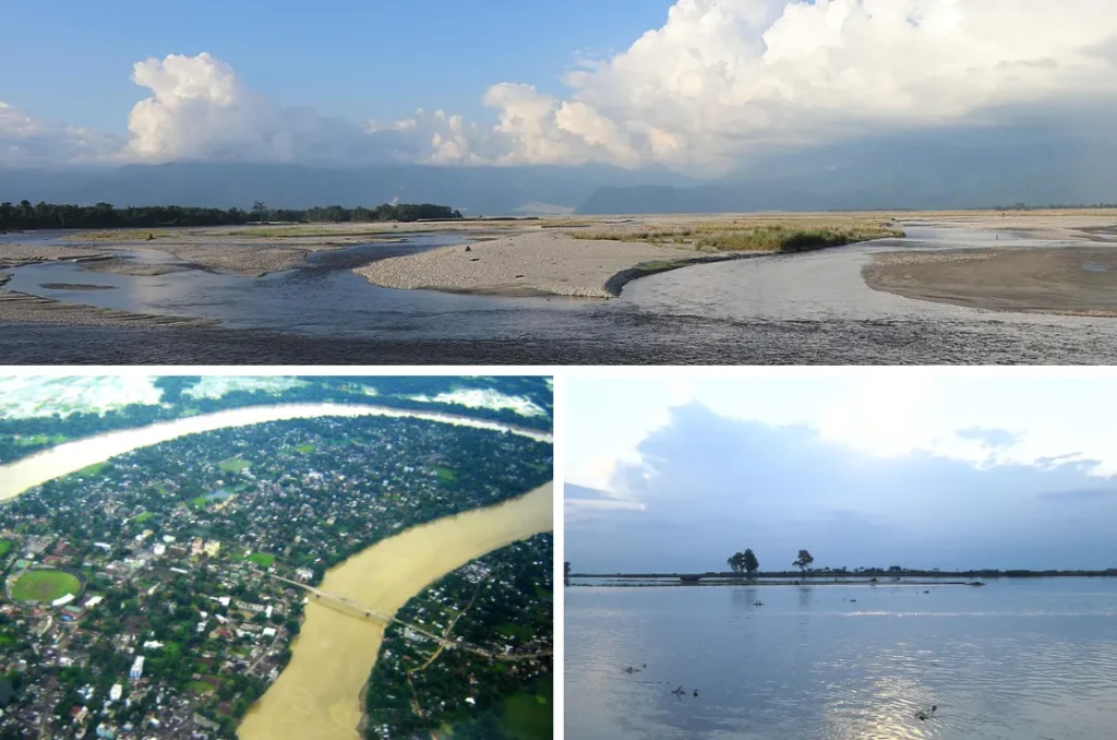
Brahmaputra River, Assam
The Brahmaputra River is a transboundary river and the sixth-longest river in Asia. The river starts near Mount Kailash in the Tibetan Plateau and flows east for more than 2,900 kilometers until it reaches the Bay of Bengal. In Tibet, it’s called the Yarlung Tsangpo River. In India, it’s called the Brahmaputra and flows through Assam. In Bangladesh, it becomes the Jamuna and later merges with the Ganges River. This river is important for transportation and watering crops in the countries it goes through: India, Bangladesh, and Tibet. The Brahmaputra River is home to many different kinds of animals, some of which are in danger of disappearing.
Barak River, Manipur
The Barak River flows for 900 kilometers through parts of India and Bangladesh. It travels through the states of Manipur, Nagaland, Mizoram, and Assam in India. Then it goes into Bangladesh where it splits into the Surma river and the Kushiyara river. Most of the Barak River is in India, with 524 kilometers in India, 31 kilometers along the border between India and Bangladesh, and the rest in Bangladesh. The river has an area where the water and the land around it are home to many different types of plants and animals.
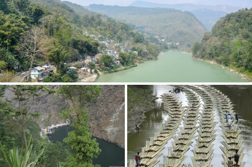
Myntdu River, Meghalaya
The Myntdu River in Meghalaya is an important river in the Jaintia Hills District. Locally, it’s called ‘ka Tawiar ka Takan,’ which means ‘Our Guardian Angel.’ It starts at Mihmyntdu near Jowai town, at a height of 1420 meters above sea level. The river flows around Jowai from three sides, leaving the northern part open. It has steep drops in its path, making it suitable for hydro-power projects. The Myntdu River forms the Myntdu Valley near Jowai, which benefits from its water for irrigation. It flows southwards through Leshka and Borghat village and enters Bangladesh as ‘Hari’ river. Local people consider the Myntdu River their protector and provider. They even perform ceremonies to appease the river.
Tiau River, Mizoram
The Tiau Lui River, also known as Tio River, is a 159-kilometer-long river that acts as a border between India and Myanmar. It has been an important place for people to cross the border from both sides. Over time, it has turned into a place where you can buy all sorts of imported items. The river starts near Khuangphah village in the Champhai district of Mizoram. On the Indian side of the river, there’s a place called Zokhawthar. On the Burmese side, you’ll find Tio Khawmawi village. In the local language, the river is also called Ciau River or Ciau Guun, with “Guun” meaning river.
Doyang River, Nagaland
The Doyang River is the biggest and longest river in Nagaland. It is also known as Dzu or Dzulu and flows in Kohima and Phek Districts before entering Wokha District. The Doyang River begins in the north and flows east. It meets another river called the Saju River, which flows east too. Then the Doyang River turns northwest into the Zunheboto district, becoming a border between Sema and Lotha areas. It takes a westward turn near Litami and enters the Wokha District. Many small streams from different districts join the Doyang River. This river is really important for all of Nagaland because it gives enough water for farming and other uses.
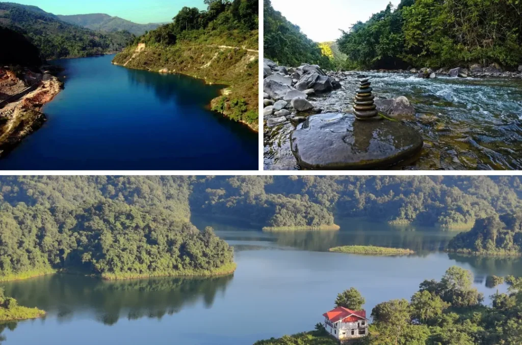
Rangeet River, Sikkim
The Rangeet river starts in the Himalayan mountains in West Sikkim district. It’s also a border between Sikkim and Darjeeling district of West Bengal. This river gets water from melting snow in the Himalayas in early summer and from heavy rains between June and September. It’s a favorite for people who like rafting because it has fast-moving water. The river flows through towns like Jorethang, Pelling, and Legship. In its last part, it meets the Teesta River at a place called Tribeni, which is a nice spot for picnics. There’s a hydropower plant on the Rangeet river that makes electricity, with a capacity of 60 megawatts (80,000 horsepower) in Sikkim.
Longai River, Tripura
The Longai River is well-known for being a river that crosses borders in the Indian subcontinent. It originates at the Jampui Hills in Tripura and flows through Assam before entering Bangladesh, maintaining a fast current throughout its course. Its extended course makes it appealing and it gains tributaries as it passes through different areas in both countries. This river plays a crucial role in supporting irrigation projects in both India and Bangladesh. These tributaries come from the Indo-Burman Ranges in Tripura and Assam in India, causing significant changes in various parts of Bangladesh.
Teesta River, Darjeeling
The Teesta River begins in the Pauhunri Mountain in the eastern part of the Himalayas near Chunthang in Sikkim. This river flows through the Indian states of Sikkim and Darjeeling District of West Bengal, and then it goes into Bangladesh through the Rangpur division. In Sikkim, the Teesta River is the biggest river, and in West Bengal, it’s the second largest after the Ganges. The Teesta River has the most water during the summer months because of heavy monsoon rains and melting glaciers. In its lower parts, it often floods and its path can change suddenly and violently.
Telegram Channel
Join Now